
space farming 🛰️
giving farmers an edge

💫 special edition
space policy: farms 🚜
If you’re new to “regs,” welcome. I have a joke-y hypothesis that “space policy” is going to become a “thing” (spoiler: it is already!) and that we should all learn more about the rules and regulations that govern the geocorona so that we are #prepared. And in this strange moment where we’re all confined to our homes, I’m finding it helpful to think about outer space (sometimes).
have a little space policy on the weekend, for a treat.
To that end, I’ve spent a little bit of time learning about the relationship between farming and satellites. For instance, did you appreciate that satellites were helping farmers find efficiencies? I did not.
“Using satellite navigation (GPS) enabled farming equipment to support precision agriculture has saved farmers $500-550 million/year in terms of improving yield, and more efficient use of seeds, fertilizer and irrigation.”
*Previously, I shared out this 2019 report from the Ministry of Innovation, Science and Economic Development: A New Space Strategy for Canada. 👇
“Today, Canadians continue to benefit from space. In fact, it is now an integral part of daily life in Canada, helping connect and inform us all, enabling everything from navigation, cell phone services and television broadcasts to financial trans-actions.”
See? Space is part of EVERY day.
Here’s the thing: fewer than 10 per cent of Canadian farms currently use satellite imagery to support activities. This could be because most of the farms (like 98%) in Canada are smaller, independent family-run shops. But it makes you wonder whether satellite imagery for crop management is an accessible option. And look, the important thing is: if you’re into farms, you can also very much be a space policy pro.
Increasing this rate from 10 to 25 per cent by 2027 could lead to cost savings to farmers in the range of $650M to $1.3B, depending on crop type. In addition, greater use of satellite navigation in precision agriculture could lead to cost savings of $800M per year by 2027 (Euroconsult 2018).
The 2016 Census of Agriculture provides a statistical portrait of Canada's agriculture industry and its farm operators and families.
Total # of farms: 193,492
Total farm area: 158.7M acres
Land in crops: 93.4M acres
Average age of farm operators: 55
Remote sensing satellites provide key data for monitoring soil, snow cover, drought and crop development. Rainfall assessments from satellites, for example, help farmers plan the timing and amount of irrigation they will need for their crops.
Fun fact - Last year, the Canadian Space Agency (CSA) awarded just over $15M in funding to 25 companies for its Space Technology Development Program (STDP). In March (on the 11th), $3.5M in contracts was awarded to 5 technologies for the development of enabling space technologies for future missions.
precision farming
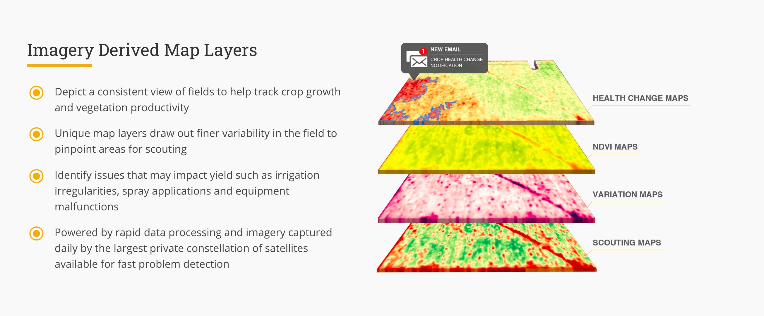
So, how do farms use satellite imagery to support their activities? I found this American company called Farmer’s Edge. Apparently they can capture imagery daily from the “largest private constellation of satellites in the world,” which makes them able to provide timely, field-level insights from planting to harvest.
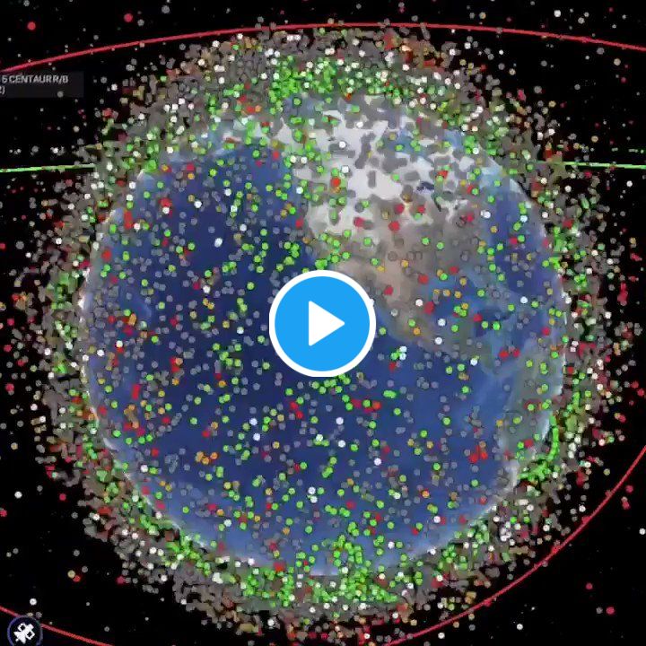
Mostly that just left me wondering - what is the largest private constellation of satellites in the world? Answer: SpaceX’s “Starlink,” system has ~182 satellites, “Planet” has a constellation (get it?) of 150 remote-sensing satellites and previously held the record.
Another example of a precision farming tool is the Earth Observatory System’s Crop Monitoring page.

So there’s both government monitoring for national/regional reporting, and commercial monitoring options to support agribusiness. These new farming techniques report on issues such as crop health, potential yield, and how to increase productivity through more precise data on factors such as irrigation, use of fertilizers, and identifying problematic/high performing areas. Satellites technologies are playing their role in activities, such as GPS-enabled vehicle tracking and in the utilization of imagery.
And FYI, regulatory paperwork gets filed with the United Nations’ International Telecommunications Union (ITU).
And which farmers use them in Canada? I couldn’t really figure that out. But I’m definitely interested in the tension between satellites as a public asset versus commercial enterprise. How should governments help more farmers use this cool technology? Or should only the savviest farm operators save cash on seeds and irrigation?
Learn more 👇
Canadian Space Agency - Agriculture in the satellite age
Medium - How Satellites Are Making Agriculture More Efficient
Canadian Geographic - Farming From Space
The Guardian - Rise of the smart farm: get ready for satellite-controlled cows
Medium - Satellites vs. Drones: The Technology in Your Vegetables
New York Times - How High Tech Is Transforming One of the Oldest Jobs: Farming
🎶 lou reed - satellite of love
Satellite's gone up to the skies
Things like that drive me out of my mind
I watched it for a little while
I like to watch things on TVSatellite of love
Satellite of love
Satellite of love
Satellite of
PS. Speaking of liking to watch things on TV…I’m currently watching Alex Garland’s Devs, who else is? It’s about quantum computing and determinism. You know Garland’s work from The Beach, 28 Days Later, Ex Machina, Annihilation, Never Let Me Go, Sunshine, etc.
*One way I know it’s a fictional startup is that so far, there haven’t been ANY free snacks. 😂

Vass Bednar writes “regs to riches” and is a public policy solopreneur.
She can be reached at vasiliki.bednar@gmail.com or follow her on Twitter @VassB.